What is thermal imaging?
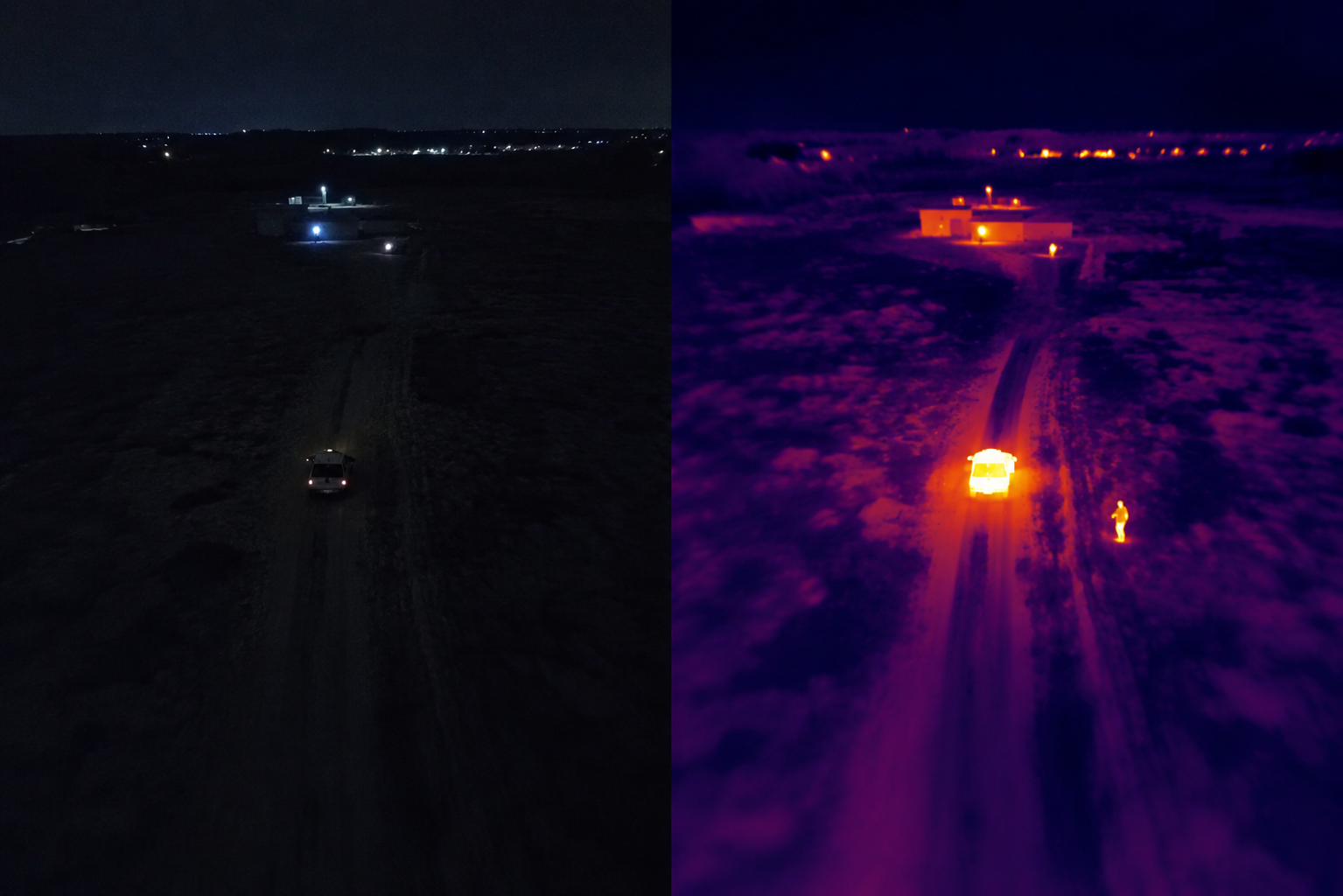
Thermal imaging is a way to make heat visible. A normal camera depends on visible light reflected from a scene. A thermal camera reads infrared radiation, which is energy emitted by people, animals, objects, equipment, ground, water, roofs, roads, and other surfaces.
The camera converts that infrared energy into an image. Warm and cool areas appear as contrast, so the viewer can understand temperature patterns that would be invisible to the human eye.
How a thermal camera creates an image
A thermal imaging camera uses an infrared lens, a thermal sensor, and image processing electronics. The lens passes long-wave infrared energy to the sensor. The sensor measures small differences in energy across thousands of pixels. The processor then turns those readings into a thermal image.
The result is not a normal photograph. It is a temperature-contrast map. The colors or grayscale tones depend on the palette and settings, but the underlying information comes from heat differences rather than visible detail.
What a thermal image really shows
A thermal image shows surface heat patterns. That can reveal a warm engine, a person in a dark field, heat leaking from a roof, a hotspot on electrical equipment, or a temperature change across land or water.
It is important to read thermal images correctly. Thermal imaging does not see through solid walls, and it does not automatically identify the reason for every hotspot. It gives a strong visual clue, but the operator still needs context.
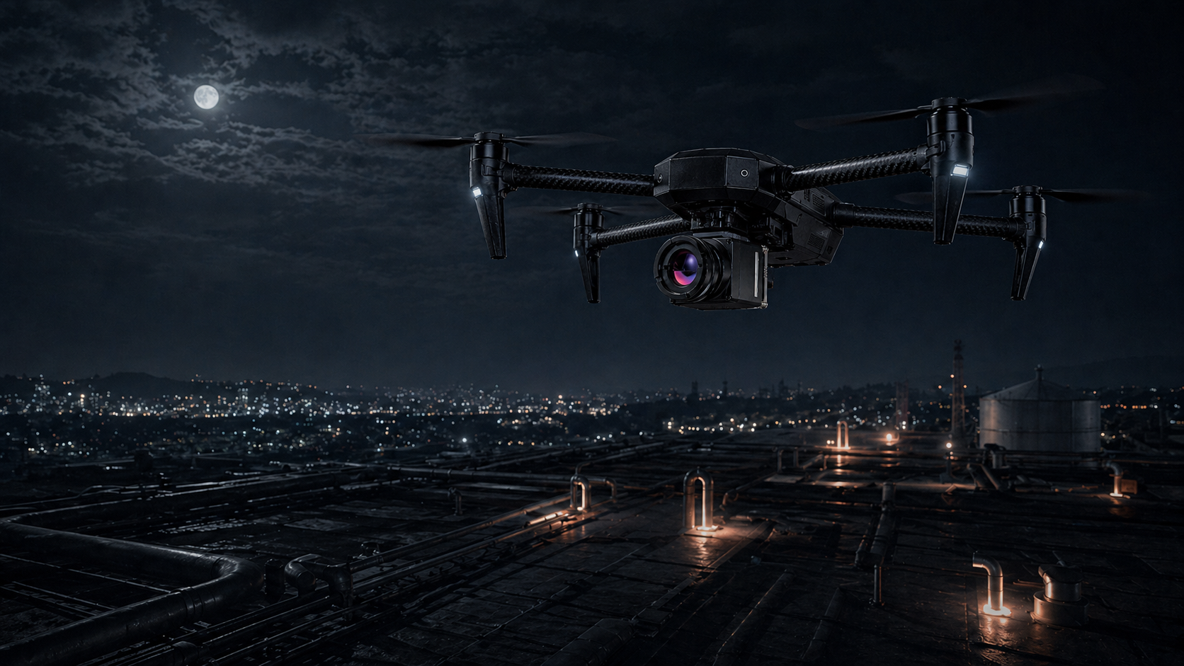
Why drones change the perspective
A drone gives the thermal camera height, mobility, and speed. Instead of looking from one fixed point, the camera can scan roofs, terrain, industrial sites, roads, structures, or open areas from above.
That aerial view makes thermal imaging easier to use at scale. The value is not only that the camera sees heat. The value is that it can collect thermal data from angles and distances that would be difficult, slow, or unsafe from the ground.
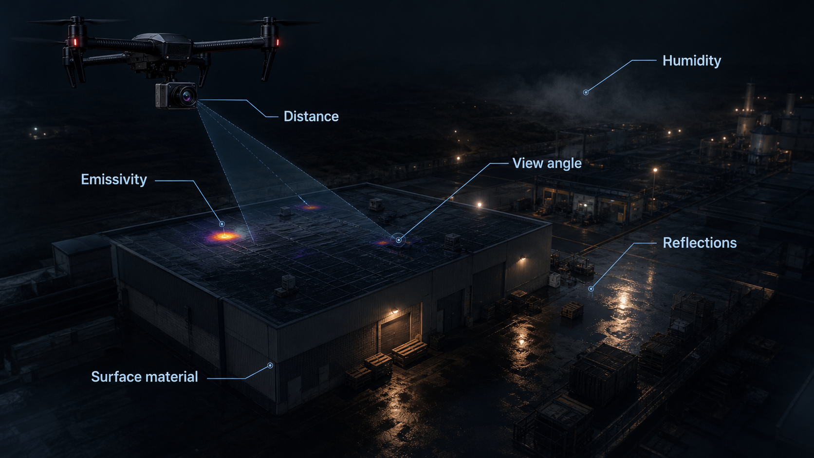
What affects thermal image accuracy
Thermal readings are influenced by more than the camera. Weather, humidity, rain, fog, snow, air temperature, distance, viewing angle, surface texture, emissivity, and reflective materials can all change how a scene appears.
For example, metal and glass can reflect thermal energy from other sources. A wet surface can look different from a dry surface. A target viewed at a sharp angle can appear less clearly than the same target viewed directly.
How to read thermal drone footage
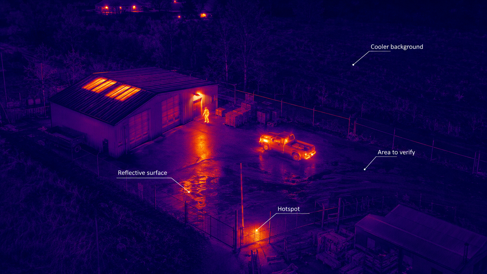
Good interpretation starts with patterns, not single pixels. Operators usually compare warmer and cooler areas, look for anomalies, check whether the heat pattern matches the scene, and confirm findings with visible imagery or ground inspection when needed.
Camera settings also matter. Palette choice, temperature span, focus, distance, flight height, and calibration can make the same scene easier or harder to understand.
Common misunderstandings
Thermal imaging is powerful, but it is not magic vision. It does not automatically see through walls, does not replace trained inspection, and does not guarantee exact temperature readings in every condition.
The strongest results come when the camera, flight plan, environment, and operator workflow are matched to the inspection goal. That is why thermal drone imaging is best understood as a decision-support tool: it helps people notice heat patterns faster and act with better information.